GFree DC Metro Map
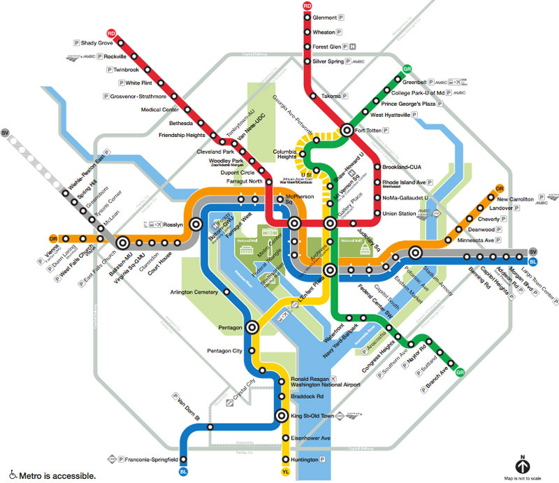 |
| Image from https://www.wmata.com/schedules/maps/upload/2017-System-Map.pdf |
Red
- Shady Grove
- Rockville
- Twinbrook
- White Flint
- Grosvenor- Strathmore
- Medical Center
- Bethesda
- Friendship Heights
- Tenleytown- American University
- Van Ness- University of the District of Columbia
- Cleveland Park
- Woodley Park- Zoo/ Adams Morgan
- Rise Bakery
- Dupont Circle
- Farragut North
- Metro Center
- Gallery Place/ Chinatown
- HipCityVeg
- Judiciary Square
- Union Station
- NoMa- Gallaudet University
- Rhode Island Avenue
Orange
Yellow
Green
Blue
Silver

Comments
Post a Comment